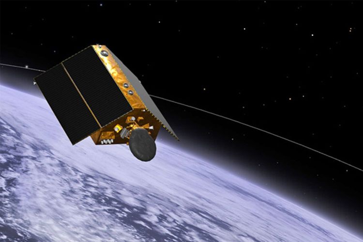
The Copernicus Sentinel-6 Michael Freilich
, launched on 21 November, will provide crucial information about sea level rise and critical inputs for weather forecasting through high-precision measurements of Earth’s oceans. The new satellite will be ensuring continuity in the long-term climate data record on sea-level, supporting policy decisions on mitigation, adaptation and climate impacts – underpinned by science.
Sea level rise is a key indicator of climate change and its monitoring is essential to for the protection of lives and property. The partners in the mission are the European Commission, European Space Agency (ESA), European Organisation for the Exploitation of Meteorological Satellites (EUMETSAT), and the United States’ National Aeronautics and Space Administration (NASA) and National Oceanic and Atmospheric Administration (NOAA), with support from the French Space Agency (CNES).
“Sentinel 6 Michael Freilich data will expand the unique record of mean sea level, whilst improving it further with measurements of unprecedented accuracy and closer to coastlines. The data will improve forecasts of high-impact weather and climate features that are strongly influenced by the ocean, like heat waves, tropical cyclones and unusually warm or cold summers and winters,” said EUMETSAT Director-General Alain Ratier.
Dr Steve Volz, Assistant Administrator of the US National Oceanic and Atmospheric Administration’s (NOAA) Satellite and Information Service, added: “NOAA will use Sentinel-6 data in many ways, including using sea levels to estimate the heat stored in the upper layer of the ocean, which will help improve hurricane intensity forecasts.”
Sentinel-6 Michael Freilich will make a a vital contribution to the space-based component of the WMO integrated Global Observing System (WIGOS). It will enhance climate research and science and support WMO efforts to improve early warnings of tropical cyclones and hazards like coastal inundation.
With NASA’s Eyes on the Earth web-based app, you can tag along with the U.S.-European satellite as it orbits the globe, gathering critical measurements of our changing planet.